In today’s interconnected world, accurate location information is a crucial aspect of various applications and services. Whether you’re planning a vacation, tracking a shipment, or conducting scientific research, finding the latitude and longitude of a specific location or place can provide valuable insights and enable precise positioning. In this authoritative article, we will delve into the realm of latitude and longitude, exploring the methods, tools, and vendors available to help us find these coordinates.

Table of Contents
What are Latitude and Longitude
Latitude and longitude are the geographical coordinates that define any point on Earth’s surface. Latitude measures the distance north or south of the Equator, while longitude indicates the distance east or west of the Prime Meridian. Together, these coordinates form a global grid system, allowing precise location identification.
Following are two efficient and popular methods of finding latitude and longitude coordinates of any desired location:
Using Google Map
Go to Google Map, there you can either enter your city,state,zip in search box and your location would be referenced on adjoining map or you can manually find the place on map by zooming into the map. Once you have identified the location, there right click on map position and select option “Directions from here”, accordingly a pointer will be set on the map point. Then right click on hyperlink named ‘Link’ at upper right corner of map and copy link location or link shortcut and paste it to notepad and look for something like following in it, text in bold below are your decimal latitude and longitude coordinates – UTF8&ll=19.333822,72.855492&spn=0.046003,0.072098&z=13

To convert the above decimal coordinates in Degree, Minutes and seconds form, you must paste these values again in Google map search box and you would be taken directly to the location on map also showing coordinates fo your home location in degrees, minutes and seconds
Other method to find location coordinates is the direct one, you just need to point the location on map and would see all the necessary lattitude and longitude details in font of you –
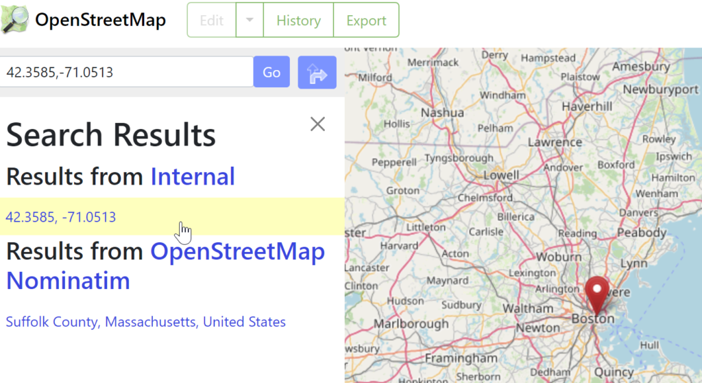
Using OpenStreetMap
For those seeking an open-source alternative, OpenStreetMap (OSM) offers a crowd-sourced mapping platform that allows users to contribute and access geospatial data. With a global community of mappers, OSM provides latitude and longitude information alongside a host of other map-related data.
Pros:
- Open-source and community-driven, allowing for constant updates and improvements.
- Extensive range of mapping data available.
- High degree of customization and flexibility.
Cons:
- User interface may be less intuitive compared to other commercial solutions.
Using Geocoding APIs to get Lats and Longs
Geocoding Application Programming Interfaces (APIs) are powerful tools that convert addresses or place names into latitude and longitude coordinates. They provide developers with programmatic access to geolocation data, empowering them to integrate location services into their applications and websites seamlessly.
Following are some prominent Geocoding API providers:
Google Geocoding API
Google offers a dedicated Geocoding API that leverages its extensive mapping database. This API allows developers to geocode addresses and retrieve precise latitude and longitude information. It also provides additional geospatial features such as reverse geocoding, enabling the conversion of coordinates back into human-readable addresses.
Pros:
- Comprehensive and accurate geocoding service.
- Regularly updated and improved by Google’s vast resources.
- Integration with other Google services and platforms.
Cons:
- Cost implications for high-volume usage.
- Dependency on Google’s infrastructure and potential service disruptions.
MapQuest Geocoding API
MapQuest’s Geocoding API is another popular choice for developers seeking geolocation services. It offers a range of features, including batch geocoding, which allows for the processing of multiple addresses simultaneously. MapQuest’s API provides latitude and longitude coordinates with high precision and reliability.
Pros:
- Reliable and accurate geocoding services.
- Batch geocoding capabilities for efficient address processing.
- Developer-friendly documentation and support.
Cons:
- Limited free tier and potential costs for high-volume usage.
- May have fewer additional features compared to other providers.
While geolocation services offer numerous benefits, it is important to acknowledge their limitations. Factors such as signal strength, atmospheric conditions, and technical errors can affect the accuracy of coordinates. Additionally, privacy concerns arise due to the collection and storage of location data, necessitating careful consideration and consent from users.
Latitude and longitude provide us with the keys to navigate our world with precision. With digital solutions like Google Maps, OpenStreetMap, and Geocoding APIs at our fingertips, we can unlock the potential of location-based services in various domains. However, it is essential to weigh the pros and cons of different vendors and tools to make informed decisions based on our specific needs. By embracing the power of geolocation, we can unlock new possibilities, enhance our understanding of the world, and navigate with confidence.